

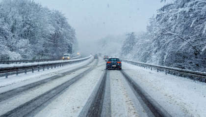
Met Éireann have warned that temperatures are to drop below freezing, after Status Yellow temperature and ice warnings were placed in several parts of the country this morning.
The warnings which were effective until 10am this morning, were issued for Connacht, Offaly, Longford, and Westmeath, with the weather to remain cold until tomorrow, with ice and sleet predicted, as temperatures drop to -4C.
This morning will be largely frosty, with patches of freezing fog expected. Temperatures are to drop to -3C tonight, with the midlands and west worst affected.
Met Éireann have also warned of slippery conditions underfoot, as well as difficult travel conditions, and animal welfare issues.
These conditions are expected to last until tomorrow, with the weather turning milder, with temperatures rising to 11C, with a return to a "frost-free" night.
“On Tuesday morning, there will be very cold conditions with widespread frost and ice, a low temperature and ice warning is in place for Connacht, Longford, Offaly and Westmeath, where the lowest temperatures have been forecast,” Linda Hughes, Met Éireann meteorologist explained.
"Then through the day on Tuesday, there's going to be generally a lot of dry weather with sunny spells", she continued. “A little bit of cloud here, near the east coast, with some patches of light rain or drizzle there during Tuesday, otherwise mostly dry with some isolated showers".
"Some outbreaks of rain will develop in the southwest, so it's going to be another cold day for Tuesday with highest temperatures about 2 to 7C".
Frosty & icy to begin for many today, Tuesday, giving way to a mostly dry day with sunny spells🥶🌥️
— Met Éireann (@MetEireann) December 5, 2023
Less cold, but cloudier, near the east coast, with patchy rain & drizzle☁️🌧️
Afternoon highs of 3 to 7 degrees in mainly light variable breezes🌡️🍃 pic.twitter.com/O1LtnVX6Sf
Met Éireann have also stated that temperatures are to drop again this evening into tomorrow morning for most areas.
“Tuesday night is going to be another very cold night, so temperatures again are going to be falling to -2 or -3C in some places", Hughes said “Milder conditions are going to start moving into the southwest later on Tuesday night towards Wednesday morning".
“That's the end of the cold weather for now", Hughes added. “So from Wednesday onwards, it's going to feel much milder than what we've been having recently".
“We'll see daytime temperatures getting up to between 7 and 11C from Wednesday onwards, so much milder and then we’ll have frost-free nights too".
Elsewhere, outbreaks of rain are also predicted for some parts of Munster and south Leinster, as the weather is set to become very unsettled from tomorrow, possibly leading to spot flooding in places.
"There is a spell of quite windy weather forecast on Wednesday and then again on Thursday. It's going to be very unsettled", Hughes explained.
Heavy rainfalls are also predicted for Thursday evening, with further risks of spot flooding in the southwest.
A mixture of sunny spells and showers are predicted for most parts of the country, with highest temperatures ranging from 8 to 11 degrees, with fresh to strong gusty winds.
As for Thursday night, heavy showers are expected for the south and southwest, with clear spells and showers predicted for other parts. Heavy rain will continue to clear from the north overnight, with temperatures dropping to between 4 and 8 degrees.
 Dublin 'Portal' May See Changes Due To 'Inappropriate Behaviour'
 Smoking Age Set To Rise To 21 Under New Legislation
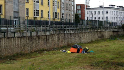 30 More Tents Pitched Along Dublin's Grand Canal
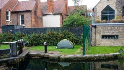 Tents Removed From Grand Canal As Asylum Seekers Relocated
 Number Of Tents Pitched Along Grand Canal Rises To 100